This blog is about travelling through Japan on a bicycle. Initially on a foldable bicycle (Brompton) and more recently mostly by road bike (Spezialized)... but also by train, ferry, plane, bus or any other transport, if sea, weather, mountains or the like come between me and my desire to ride.
I have tried to summarise information that could be potentially helpful also for other bicycle travellers through Japan, such as list of bicycle roads, helpful web pages etc.

Tuesday 31 October 2017

Bicycle Repair

Bicycle touring Japan - Bicycle repair

This blog post is about how my brompton gets fit for the next weeks of touring through Japan.

The days in Tokyo I have used to get my poor brompton seen by a brompton specialist just to make sure everything is still in order. Well, now I have a new rear tire (the profile was quite worn down), and even more importantly new rubbers on the brakes, which were very worn down. Plus apparently the "bottom bracket cardridge" needed to be exchanged due to some manufacturing error. I hadn't heard about that recall, but this got fixed immediately as well. 

And here it is, all fixed in front of its much more colourful cousins:


Monday 30 October 2017

Part 7 (Day 33 - Day 37) - Pacific Coast Bicycle Route to Ise 太平洋サイクリングロードで伊勢へ - Summary

Bicycle touring Japan - Pacific Coast Bicycle Route to Ise - Part 7

In this post I review my ride on the Pacific Coast Bicycle Road from Shizuoka to Irago and then on towards Toba and Ise by ferry. 


Bicycle: 212 km
Other transport: 568 km
Region: Along the Pacific Coast from Shizuoka to Cape Irago and then over by ferry to Toba and to Ise, returning by train through Nagoya to Tokyo 
Total riding time: 16:00 h
Total ascent: 1,177 


While the region is very nice, unfortunately the Pacific Coast Bicycle Route in many parts is not up to it at all, being hugely overgrown by vegetation or invaded by sand dunes that make passage impossible or simply hard to find. It isn't true for the entire path, there are good stretches as well, but many bad or impassible stretches taint the image of this bicycle lane. However arriving at cape Irago did repay for a lot of it and sightseeing in Ise was also nice.


Here an approximate map of the ride as Google shows it, the actual rides are, as always, in the day-to-day descriptions:


The actual routes I took are in the Strava or Garmin feed of each day:
  • Day 33 - Shizuoka to Omaezaki
  • Day 34 - Omaezaki to Bentenjima
  • Day 35 - Bentenjima to Cape Irago
  • Day 36 - Cape Irago to Ise
  • Day 37 - Ise through Nagoya to Tokyo

And here an overview of the costs.

As per my original plan, I rode down the Pacific Coast from Shizuoka to Irago and then on with the ferry to Toba and then to Ise. In my plan of Mie prefecture, I would have continued on from Ise towards Inner Nara prefecture (taking a train at some place). However as I needed to go back to Tokyo for a few days, I stopped at Ise and then did the ride through Nara prefecture coming from Maibara instead. 

While the part between Shizuoka and Cape Irago does not have a lot of touristic highlights, Ise then is a worthwhile touristic visit, to the birthplace of Shintoism.


Also Cape Irago and specially the hotel I had stayed in at the end of the cape, was in a very nice landscape ...


... and even the ride down the long peninsula from Bentenjima to Cape Irago had its scenic spots with all those cabbage fields.


Actually most of this ride could have been done by bicycle only. The high km in other transport is mainly due to the fact that I needed to return to Tokyo after visiting Ise to take care of some work related issues. Apart from that the only non-bicycle time was under the rain between Omaezaki and Bentenjima and obviously the ferry over from Irago to Toba. If the weather would have been better essentially the entire way from Shizuoka to Ise is perfectly ridable by bicycle. Well, perfectly, with the caveat of the badly maintained bicycle path along the Pacific coast, the existence of which was one of the reasons I even had chosen this ride.

Yes, all of these are pictures of the Pacific Coast Bicycle Lane
In all fairness, also these are all images from this bicycle path, including a specific bridge

None withstanding these difficulties, actually Day 33 was the longest ride so far (76 km) and Day 35 was the one with most ascent (529 m, 74 km). So actually I did get a lot of cycling done. And weather, except on Day 34, was very good cycling weather.

Gear wise I unfortunately had my second confirmation that my rain gear is totally not up to rain. After this ride I did avoid any more rainy rides while in Japan, but sooner or later I will need to address this problem and look into a more reliable rain wear option. 

Saturday 28 October 2017

Day 37 - Ise through Nagoya back to Tokyo 伊勢から名古屋経由で東京への帰り

Bicycle touring Japan - Day 37

This blog post is about the final day the second leg of my bicycle travel (Day 7 to Day 37) through Japan, returning back to Tokyo. 

Bicycle:  less than 500 m
Train: 510 km
Route: Ise to Nagoya, Nagoya station to railway museum and back, Nagoya to home in Tokyo, all by train
Weather: Rainy and cold, probably around 15 C


After one month riding through Japan on bicycle, but also on train, bus, ferry and even taxi, today I came back home. Only for a few days to attend to some business in Tokyo next week and to escape from the rain and typhoon.

I was lucky in the morning that exactly in those few minutes it took for me to get from my hotel to the station (a very venerable one judging from its facade) it did not rain. But that was more or less the only moment of the day without rain.


Today that didn't matter though, as the plan foresaw a museum, the SCMAGLEV and Railway Park museum in Nagoya. Originally I had wanted to visit this museum already back on Day 32, but had been prevented from doing so by typhoon #21, which had severed the train connections from Takayama to Nagoya, meaning that the time I had planned to spent in the train museum, had been spent waiting for a bus to get out of the train deprived Takayama.

But today was a good day for a museum as well. Maybe not ideal, as it was Saturday and raining, so I was far from being alone in the museum.

The star of the museum without doubt is the Maglev superconducting train:


One has to admit that the interior of this test train is below expectations, but I guess they have simply put in some old normal shinkansen chairs, just to have something to sit on.


There is even a small theatre where one can experience (kind of) how a ride at 581 km/h in a Maglev train would feel like. Including the vibrations.

There is also an other room to do some shinkansen driving simulation, but the tickets for that are so few, that there is actually a lottery system, and well, I did not have luck. But at least I got a picture of me taken (in an other) shinkansen 700 class, i.e. the same type of shinkansen I would take a few hours later from Nagoya to Tokyo.


On this map a day in the shinkansen between Osaka and Tokyo (i.e. Tokaido line) can be seen, with all the colourful spots indicating shinkansen as they are leaving Tokyo / Osaka and sprinting to the opposite end of the tracks. Running just a few minutes behind the previous one, taking over the slower Hikari (red) or Kodama (blue) trains on their way.


But here in the museum they are all parked, waiting patiently to be observed by train admirers.


But it is not shinkansen only. There are also old steam, diesel and electrical trains, old wooden cars, old sleeper cars ... and many different train noses:


All with very good English explanation both on panels as well as in the audio guide.

The yellow shinkansen above, is the so-called Dr. Yellow, a shinkansen that was used for technical inspection of the tracks. The one in the museum is the old Dr. Yellow based on the original Shinkansen 0, but even today the inspection train is still yellow. Just apparently a slightly different shade of yellow.


Once upon the time, when shinkansen were not as fast as they are today, they still had board restaurants. Very stylish ones, that apparently attracted big crowds and some people specifically took the shinkansen to have lunch/dinner on the train. No more of that today...


Getting back to Nagoya station involved a ride on a Lego train!!! (Legoland is just next to the train museum):


Well with this train overkill I boarded a shinkansen to Tokyo and made my way home, where I will stay for the next few days, and then off again towards the mid and South of Japan for further rides on the bicycle!

Friday 27 October 2017

Day 36 - Irago to Ise 伊良湖から伊勢市へ

Bicycle touring Japan - Day 36

Today to my final destination of this ride along the Pacific, over from Irago to Ise, the place with the most sacred shrine in Japan. A perfect day in the sun, on the ocean and riding through rural Japan.

Bicycle:  approx. 35 km
Ferry: 21 km
Riding time: ??? (see comment below)
Total ascent: approx 200 m
Route: Hotel to Irago port by bicycle, over to Toba by ferry and then on to Ise by bike
Weather: Sunny only a few clouds in the afternoon, maybe around 20 C


Today I woke up in my nice hotel in the middle of a national park with a great view from my window over the low growing bushes, a lake and something that is probably a golf court.


And started the day with a hot bath, with similarly nice views:


The hotel (Kyukamura Irago) was hiding in the woods when I left and set of towards the ferry which would bring me over to Mie prefecture over the Irago bay.


And off with the ferry in a calm, sunny day over the bay...


... to Toba. Toba itself is a touristic destination, that somehow got famous and very ugly. So I made it quickly out of the town and over in the direction of Ise. Shortly after leaving the town of Toba, I passed this very serene maritime landscape. The nets in the center of the picture are most likely farms for pearls. At least that's what Toba is famous for.


A bit further on, I came by the Meoto Iwa, two rocks in the ocean bound together as man and wife:


In that same shrine also frogs get apparently venerated.


But to get to this shrine, at least from direction Toba, one first is kind of forced to cross a big Omiyage shopping mall. Well, there is a way around it, but it is not obvious when you arrive to the parking lot, so I - together with hundreds of Japanese - trekked through the shops full of biscuits, pearls, dried fish etc, out to the coast. If one arrived from the other side, there is actually still an approach without any touristic shops. And that's where I got out of this area and on with my ride on this dyke:


It continues for quite a while. And then I headed inland. I somehow had expected the area around Ise to be much more built up. Maybe because Ise is such a famous place in Japan, but actually it is quite rural and my route brought me nearly up to the Inner shrine (Naiku 内宮) riding through this landscape.


To the shrine an actually quite nice shopping (omiyage) street was leading. However by bike I took a small parallel street down by the river and then found a perfect parking lot where to leave my brompton while I went off to explore the most sacred Japanese shrine.

This here is the special purification place in the sacred river:


The shrine itself is so sacred, that it is nearly all hidden behind a wooden fence. Pictures are only permitted from outside of the outer most fence.


Once up those stairs, you arrive before a gateway in the fence around the shrine on which a curtain is fixed. In front of that people are praying. The actual shrine is behind a third fence and an other building and one can only get some glimps of its roof. Per the description in the guidebook it is a remarkable architecture that is NOT influenced by other asiatic (aka Chinese) architecture, as this shrine was built before such influence started. Now the shrine itself is not very old (a mere 4 years) as it is being rebuilt every 20 years.

In the shrine grounds there are also a number of other shrines, that all seem to have a very similar structure. And all with a wooden fence around them.


And it would seem that ALL of them get rebuilt every 20 years. At least there is a free building space with the gravel already laid out like on the built up plot besides all of them.


The only thing that is already on the empty plot, is a small hut, most likely at the exact location where the inner sanctuary of the next shrine will be. Looks a bit like a summer cottage for the god living currently next house.


The shrine grounds are also very nice, with huge pathways through a towering forrest. And it is definitely a spot beloved by tourists, although at the most sacred shrine there were no queues or anything, probably because for most (Chinese) tourists, there is simply not too much to see there. With most of it being hidden behind a fence.


When I had finished walking through the grounds, I returned on my bike and rode down to the Outer shrine, Geku (外宮), which is quite far away, but in the city center of Ise. Surprisingly it is also in a similar wooden area.

Also the shrines here are very similar in their architecture and also seem to get reconstructed every 20 years, with the new building plots already available.


Then on to my last hotel of this second leg of my travel through Japan, close to the station of Ise. In the evening I had even some time to explore some remaining traditional streets right behind the hotel, which are not even very touristic. Probably tourists that come to Ise are already busy enough visiting the shrines, the rock in the water and the pearl island in Toba, and do not get allotted sufficient time to also tour the city.


After all this nice sunshine today and yesterday, for tomorrow (and the day after) rain is forecasted at 100% chance. As I need to be in Tokyo anyway mid next week, I will travel back to Tokyo tomorrow (by train), sit out typhoon # 22 in Tokyo and then restart at the end of next week. Yet to be decided where, but looking now to the weather forecast it seems that finally the autumn sun will come back.


Bicycle touring Japan - Ride maps


I had been taking today mainly the route I had planned out in Garmin months ago. Unfortunately at some point I must have hit the wrong key on the device, at least none of the ride information got stored. So you can't see one of the nice changes I did to the route, riding along the ocean on top of the dyke (see picture above, right after leaving Meotoiwa).

Day 35 - Bentenjima to Irago 弁天島から伊良湖岬へ

Bicycle touring Japan - Day 35

Continuing on the Pacific Coast Bicycle Course I have today reached Irago, however most parts of the bicycle lane were not transitable (e.g. permanently closed, not yet built, covered in vegetation...). But with perfect weather, who cares?

Bicycle: 74 km
Riding time: 5:30 h
Total ascent: 529 m (no idea why, but this is a new record on this trip and also explains why I am quite tired)
Route: Bentenjima to Irago
Weather: Sunny and not a single cloud, 20 C


After the rain yesterday, today it was sunny, warm, not a single cloud. Simply perfect weather for a ride.

In the morning, before starting the ride, I was actually feeling a bit down. I guess I was simply tired, as I had not got a lot of sleep last night, due to trains passing below my window every few minutes. I thought that the last train was around midnight, but apparently all night freight trains are running...

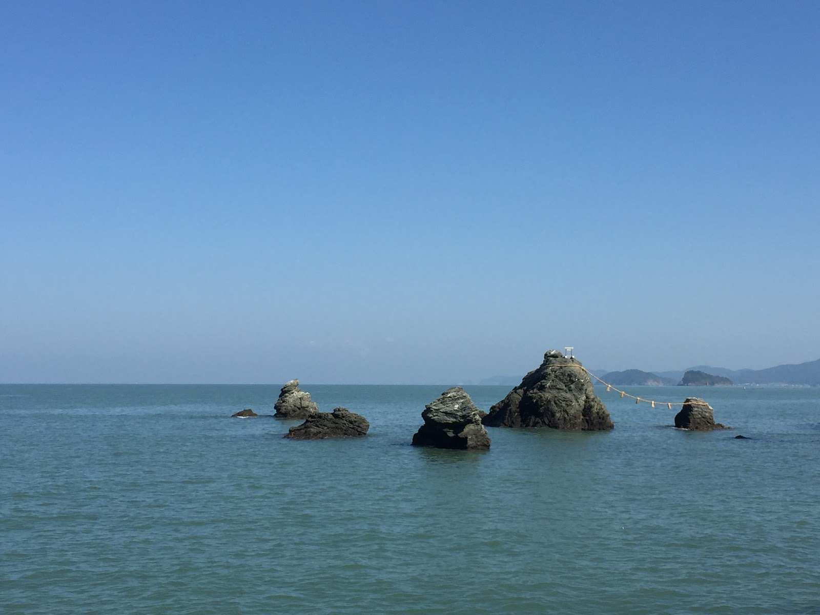
When I finally started, I took a picture of the view of the other side of the hotel, where this large torii is standing in the Hamana lake. What seems to be a romantic bridge in the background is the express way.


The hot shower my poor brompton had yesterday evening was a good thing. Today only initially a bit of strange sound came out of the front wheel direction, but as I continued to ride it got less and less. So I guess that the sand corns that had remained somewhere inside have now also fallen out.

I had plotted out yesterday a detailed Garmin route until the point where I knew (from this web page)  that the Pacific Coast Bicycle Course would restart. In summary I have to admit that my planned course was often much better than the official bicycle lane I found.

After riding out of Bentenjima I headed relatively soon (starting at km 4) into a small neighborhood road. With nice houses lining it and little to no traffic.


After some time I came to the "Michi no eki" (Rest station), got an icecream and ate it while soaking my feet in the feet-onsen. At this point I decided to make an ad-hoc change to my route, as what I had plotted looked in reality to be just the express way. So I took a small road on the sea shore.


After a few hundred meters the street became a non-asphalted way. At this point maybe I should have decided to take a road up (which was available), but initially the non-asphalted way wasn't so bad and I could actually ride it and it seemed (per Google maps) that after some time asphalt would reappear. Well, asphalt did not reappear, instead in some stretches these enormous ponds appeared.


But really this here was the only stretch where I needed to find an alternative, so I pushed the bike over the beach. This time it wasn't actually so hard, as there was some vegetation that gave the sand more consistency.


After riding a bit on this path, I finally found an other street up and took it. This did lead me into a very rural landscape, with a lot of vegetable fields (mainly cabbage), green houses (some of them actually "high-class" green houses, aka built with glass windows, not plastic, and even a few animal farms.


The roads through this surrounding were small, rural ways, but well paved.

At km 25 then the long awaited bicycle lane did officially start. Finding the entrance would not be easy if you can't read kanjis, as it is kanji only. However that was not the only problem with this bicycle lane. It started slightly overgrown, so instead of the left hand side of this picture, I rod on the right hand side where the "real" street was.


However after not too long the bicycle lane and the street parted, so I changed back on the bicycle lane, which definitely had an invasion problem:


This picture here is a wild growing green beans bush, that has nearly completely invaded the bicycle lane. I somehow made it through without getting eaten by any bean-monster.


But there were also stretches with purposely built bridges. I had again the strong suspicion that this route once upon the time was a train track, with all these bridges and also the inclination and gentle curves. I didn't see any confirmation for my suspicion on the way though.


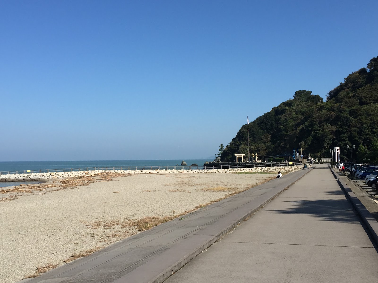
At about km 29 this expedition through the vegetation of Aichi prefecture ended at this nicely built rest place, where I had my simple lunch.


From the map that you can see behind the bicycle, it was not really clear if the bicycle lane would continue. It seemed kind of not, as the continuation was dashed. So I returned to the main road and continued there. After not too long a new sign indicated the bicycle lane and I turned. However after riding a bit on it, I came to this stop:


Which was actually totally justified, as at km 32 the vegetation had again won a decisive victory against the bicycle lane.


The supposed bicycle lane is on the right BEHIND the white fence.

And anyway this bicycle lane was going in the wrong direction (so probably this was the above mentioned dotted line).

So I made my way up again to the main road. The main road itself is actually not so bad for riding. Per the map of the area there is a bicycle lane along most of it, but generally it is just the pedestrian side walk that has been double labeled also as bicycle lane. Sometimes these kind of bike paths are rideable, sometimes less so (e.g. because of gravel, plants, bad asphalt, sudden turns...). So generally I stayed on the main road. And had a nice ride through the endless fields of cabbage, sweet potatoes, green houses etc... Also some of the villages along the route where quite nice. Nothing spectacular, but simply old relatively well maintained farm houses.

And then at km 54, there was again a sign to the mythical bicycle lane. A first attempt only brought me to a place "called" はいちゃダメ (No entry), but I was not put off so quickly. There was an other indication to the bicycle lane, so I road again down to the Pacific. And well, there it was the bicycle lane...


... however with a gate across it and more vegetation looming.

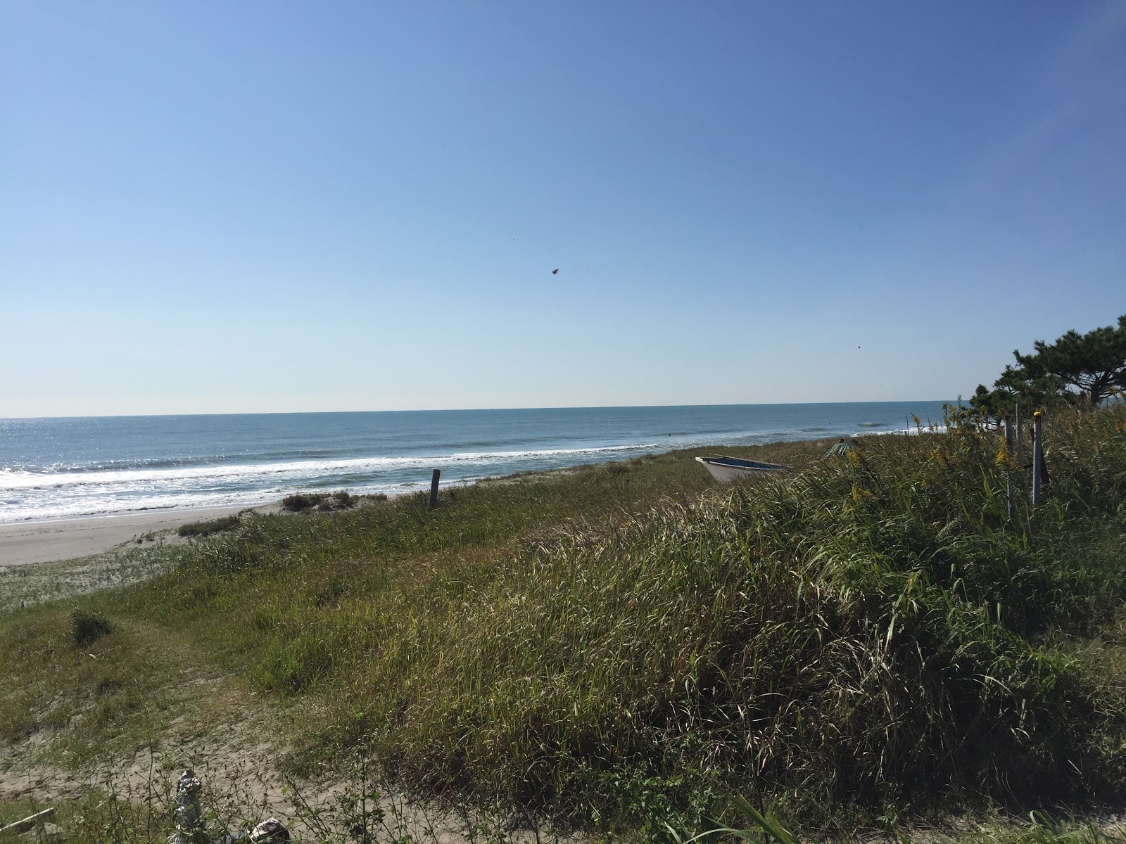
Today in several spots I came down to the beach. And while there was no one ON the beach, in all places were a considerable number of surfers in the water on their boards, waiting for the next wave. Most really were waiting. There wasn't a lot of riding. Probably also because - lucky for me - there was not a lot of wind today.

An other remarkable feature of this region is, that many sign posts are written in Japanese, Portuguese and English. This is likely because Japanese Brazilians have re-immigrated here. No idea if they also brought the surf boards with them.

So well, at this new failed attempt to get on to the Pacific Coast Bicycle Course, I returned once again up the hill to the main road. At this point I had not plotted out an alternative route throught country roads (as I had hopes for the bicycle lane), so I just stayed on the main road, which however was okay to ride. Not too many cars & trucks.

And then finally at km 63, there was it again. No announcement this time, but here it was, a perfect bicycle lane atop the beach:


This time no invasion by sand, vegetation or anything else. And it was even used by some evening walkers and a cyclist or two. The sun was slowly setting right in front of me, with the mountains around Ise in the background:


Just shortly before reaching cape Irago, the bicycle lane was again closed, but at that point I had gotten used to it and made my way up a hill just before reaching the cape, with a very nice sunset moment


Then I road quickly down towards my accommodation for tonight, the Kyuka Mura. I found an other bicycle lane, which ended rather abruptly... so I changed back to the street.


The Kyuka Mura hotel is located a bit off the cape in a flat wooden area. It is actually a surprisingly nice hotel complex, with an onsen including 2 semi-rotenburos (they are kind of inside, but there are no windows to close them from the outside, so a bit of the refreshing air comes in) and a nice buffet dinner. Even with a lot of fruits! And the view from my hotel room seemed to be very nice, but already a bit too dark to get a good shot. So I will try again tomorrow morning.

Also today internet connection is very patchy, so I will upload pictures and more details later. Hopefully tomorrow!


Bicycle touring Japan - Ride maps


For details on the bicycle tour today in Shizuoka and Aichi on the Pacific Coast Bicycle Route, checkout the below maps: